What are the advantages of GNSS Guidance Linear Irrigation?
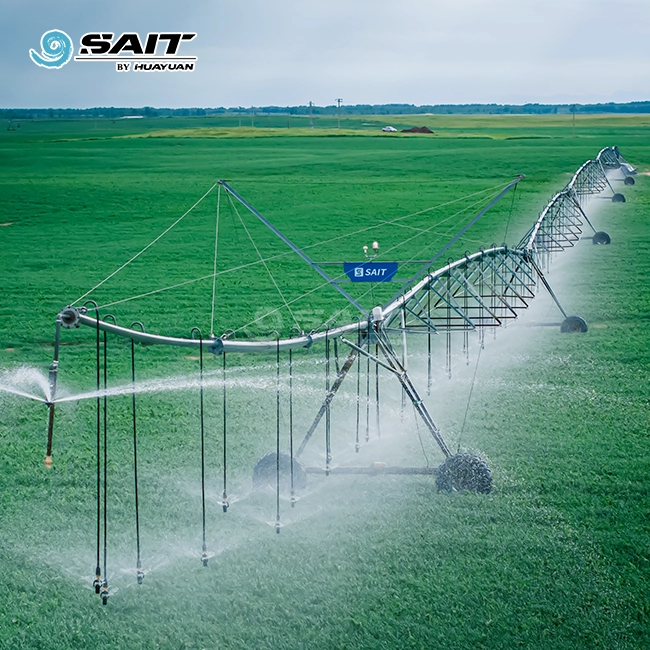
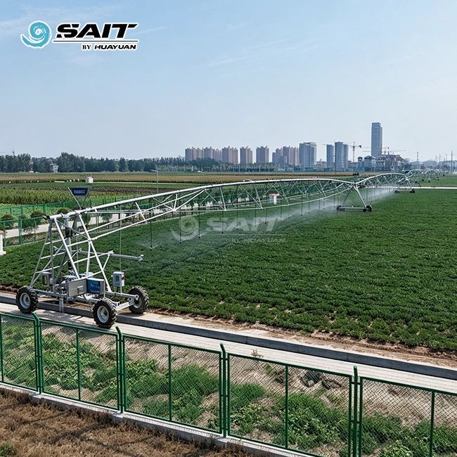
GNSS guidance linear irrigation delivers centimeter-level positioning accuracy by fusing BeiDou (BDS) and GPS dual-mode satellite signals with automated steering controls. This technology directs a lateral-move irrigation machine in a perfectly straight path, perpendicular to the equipment frame, across rectangular or narrow field layouts. The result is a field utilization rate exceeding 98%, reliable fertigation integration, and significantly reduced labor costs compared with manual or furrow-guided alternatives. For large-scale operators managing sugar beet, potato, vegetable, or grain fields, satellite-guided irrigation represents a measurable step forward in water management and operational efficiency.
Understanding GNSS Guidance Linear Irrigation


To better understand the benefits, it's helpful to know what this technology does at the system level.
What GNSS Means in an Agricultural Context
The Global Navigation Satellite System is what GNSS stands for. Instead of relying on just one network, it uses GPS, GLONASS, Galileo, and BeiDou, which are all different types of satellites. If you use Real-Time Kinematic (RTK) correction data with the system, it can actively lower the positional accuracy from a meter level to ±2–3 cm.
How It Integrates with a Linear Irrigation Machine
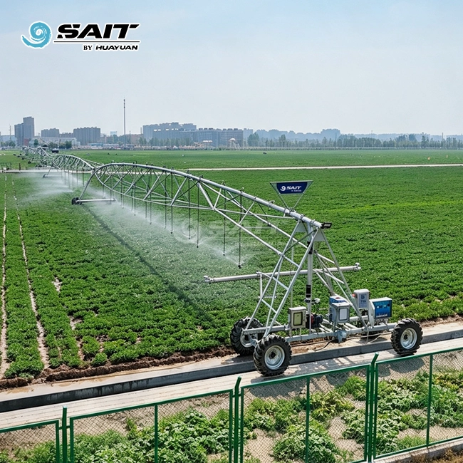
High-precision GNSS sensors on the drive towers talk to a PLC processor that is built into the machine. The driver changes the speeds of each tower motor in real time, keeping the whole span lined up along a digital path that has already been set up. This gets rid of the need for furrows or hidden wires.
The BDS/GPS Dual-Mode Advantage
HUAYUAN SAIT's lateral-move systems can use both BDS and GPS to guide them, enabling reliable satellite-guided irrigation. Running two constellations at the same time makes more satellites available, lowers the risk of signal drop in faraway fields, and keeps the path intact where single-constellation systems can lose lock.
Core Advantages of GNSS Guidance Linear Irrigation
Satellite-guided lateral-move irrigation solves real problems that farmers have with production that they have to deal with every year. This method has the following main benefits:
- Field utilization rate above 98%. Linear systems go in a straight line across the whole field, so they don't leave any unirrigated corners like center-pivot designs do. This coverage benefit is big for rectangular fields with a length-to-width ratio greater than 2:1.
- No physical guidance infrastructure required. However, the guidance furrows need to be cut again every year. To guide cables, wires must be hidden and the placement must be done correctly. GNSS guidance loads a digital path map and starts working right away, so there is no need to spend time setting up the site or maintaining physical markers.
- Fertigation-ready automation. The electronic control system, which can be set up as a standard system or with a remote control, manages when to inject fertilizer and when to send water. This helps with precise fertigation for cash crops like veggies, sugarcane, trees, and nurseries.
- Consistent path repeatability. Precise wheel-track repetition lowers soil compaction in areas that weren't meant to be compacted. This is important for potato and root vegetable growers because soil compaction directly affects the quality of their crops.
- Towable multi-field deployment. There are no furrows or cables that need to be cut or re-buried when contract farmers or cooperatives move a unit to a new plot. It only takes minutes to load a new digital path.
When buying, teams compare lateral-move systems to center-pivot options; they usually worry about cost and stability. These pros take care of those issues.
GNSS Guidance vs. Traditional and Other Precision Methods
Buyers can make better buying choices when they know where satellite guidance works better than other ways.
Furrow Guidance Limitations
Furrow guide is cheap to buy, but it needs to be re-cut every year, breaks down on slopes, and throws off the line of the span when the furrows wash out. When areas are longer than 400 meters, cumulative tracking mistakes become a problem that needs to be fixed.
Cable Guidance Limitations
While buried cable systems are more accurate than furrows, they need to be installed in deep trenches, put field workers in danger, and have high repair costs when plowing damages the cables. Any change to the field plan means re-burying the wire.
Why GNSS Outperforms Both
Satellite guidance gets rid of both of these physical needs. An Inertial Measurement Unit (IMU) combined with RTK correction handles terrain compensation on uneven ground, stopping cable systems from "snaking" when they go across cross-slopes. When the RTK base station signal is briefly lost, onboard algorithms keep the robot moving in a straight line for up to 20 minutes using updates sent by satellite. This is a useful failsafe for fields that are far away.
Procurement Considerations for GNSS Guidance Linear Irrigation Systems
When buyers look at lateral-move systems for the first time, they have to make a number of technical and business choices.
Guidance Mode Selection
On the same machine platform, HUAYUAN SAIT has three guidance modes: furrow, cable, and BDS/GPS dual-mode satellite. Buyers can start with cable guidance for a single demonstration unit and then switch to GNSS guidance linear irrigation for larger deployments without having to buy a new base machine.
Configuration Parameters to Review
Before you send out a buy order, make sure that these details fit the conditions in your field:
- The longest machine can be up to 973 meters long; it can effectively water up to 800 meters of land, and it can travel up to 3,000 meters, which means it can cover up to 240 hectares per unit.
- You can choose from span lengths of 37.5 m, 43.3 m, 49.1 m, and 54.9 m.
- Widest part of the pipe: 168 mm or 219 mm
- Different ways to get water: through a stream or a drag hose
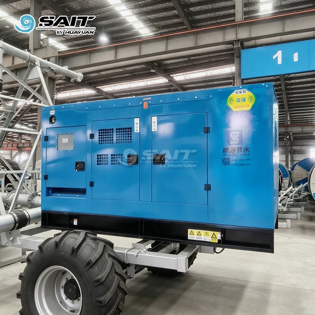
- Power source mode: towed wire or generator (important for fields that are far away and don't have access to the power grid)
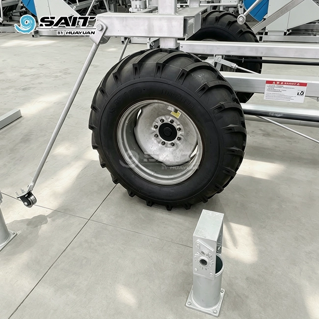
- Wheel choices include 11.2-24, 14.9-24, or 16.9-24, with or without tubes.
After-Sale Support and Parts Longevity
Parts need to be available when the system runs on 240 hectares per unit. HUAYUAN SAIT offers a full guarantee for one year, low-cost upkeep and part replacement for three years, and spare parts at the original cost price for life. The technical foundation of each unit can be checked because the company has been making them for 20 years and has over 130 patents, including 35 invention patents and 15 international patents.
Installation, Maintenance, and Troubleshooting Tips

Even a well-designed satellite-guided system needs to be set up correctly and be checked on a regular basis to make sure it works right.
Site Assessment Before Installation
Which type of drive unit—two-wheel or four-wheel—is right depends on the field gradient and the soil's ability to hold weight, especially for satellite-guided irrigation systems operating across different terrains. For crops with a tall canopy, there are choices with a high clearing width. If you do this step right, you can keep the machine from experiencing structural stress and alignment wear over its lifetime.
Routine Calibration and Software Updates
When they are first turned on, RTK receivers should go through a 24-hour static fix verification. Dynamic accuracy is within 2.5 cm, as shown by field-trial path deviation tests. Firmware changes for the GNSS receiver and PLC processor should be done on the plan set by the maker. HUAYUAN SAIT's remote control system can check for updates automatically.
Handling Signal Interference
When high-voltage power lines run straight to the field, they can mess up GNSS devices' electromagnetic signals. In this setting, receivers that are rated to IP67 or IP69K and protected from EMC interference work well. Using both BDS and GPS at the same time also lessens the effect of signal blockages in certain areas, like near grain storage structures or tree rows.
Conclusion
Large-scale field owners can use satellite-guided lateral-move irrigation to get more out of their land, save money on labor costs, and make sure that water and nutrients get to the plants more consistently. The technology works with different types of power sources, like grid, generator, or pulled cable. It also works with different types of water sources, like river and drag hose. GNSS guidance linear irrigation systems from a manufacturer with proven technical depth are a good long-term investment for procurement teams looking for irrigation equipment for rectangular fields, government reclamation zones, or cooperative operations with multiple parcels.
FAQ
Q1: How much water can a GNSS-guided lateral-move system save compared with flood irrigation?
Studies show that precise lateral-move irrigation uses 30–50% less water than surface flood methods, and the uniformity of the irrigation is higher than 90%. With HUAYUAN SAIT's devices, the missed irrigation rate is below 5%, meaning fewer plants fail to receive enough water.
Q2: Can the GNSS guidance module be added to an existing lateral-move machine?
CAN bus or dry-contact switches are the most common ways for GNSS guidance devices to connect to current tower control boxes. Compatibility depends on how the base machine is wired. Please call our expert team with the details of your present model.
Q3: What happens if the RTK base station loses signal in a remote field?
If the RTK signal goes out, the internal IMU and satellite-delivered correction algorithms keep the vehicle moving in a straight line for up to 20 minutes. After that, they do a controlled stop to avoid damage to the alignment.
Q4: Is operator training required for satellite guidance systems?
Yes. HUAYUAN SAIT offers localized instructions, on-site installation help, and user training in the buyer's language. One to two days of guided training are usually needed to map out the first path and set up the RTK base station.
Ready to Source a GNSS Guidance Linear Irrigation System? Contact HUAYUAN SAIT
HUAYUAN SAIT is a direct-factory GNSS guidance linear irrigation manufacturer that has been making products for 20 years, has over 130 patents, and can make 1,800 units a year. Our BDS/GPS dual-mode lateral-move systems can be shipped within a week from our warehouse near Xuzhou. We offer full OEM and ODM support. To get a field coverage analysis, configuration quotes, or a demonstration unit proposal, email our technical team at kevin@showyirrigation.com.
References
1. Food and Agriculture Organization of the United Nations. Crop Evapotranspiration: Guidelines for Computing Crop Water Requirements (FAO Irrigation and Drainage Paper No. 56). FAO, 1998.
2. Camp, C.R. Subsurface Drip Irrigation: A Review. Transactions of the ASAE, 1998.
3. Dukes, M.D., Zotarelli, L., & Morgan, K.T. Use of Irrigation Scheduling Technologies and Practices in Florida. HortTechnology, 2010.
4. Evans, R.G., & Sadler, E.J. Methods and Technologies to Improve Efficiency of Water Use. Water Resources Research, 2008.
5. Hedley, C.B., & Yule, I.J. Soil Water Status Mapping and Two Variable-Rate Irrigation Scenarios. Precision Agriculture, 2009.
6. Martínez-Romero, A., et al. Benefits of Precision Irrigation and Fertigation in Vegetable Production: A Review. Agricultural Water Management, 2021.
Get a tailored irrigation solution for your project — our engineering team is ready to support you from design to installation.